Turn Left at the Old Barn: The Forgotten Skill of Finding Your Own Way
Ask someone for directions in rural America forty years ago and you'd get something like this: Go down to the light, hang a left, follow that about three miles until you pass the grain elevator, then it's the second road on your right after the creek bridge. You'll know you've gone too far if you hit the county line. No coordinates. No street names. A set of instructions built entirely from landmarks, distances measured in minutes rather than miles, and the assumption that you were paying enough attention to recognize a grain elevator when you saw one.
This was normal. This was how people navigated. And it worked — not perfectly, not always, but reliably enough that generations of Americans moved through unfamiliar landscapes with a confidence that seems almost exotic now.
The Atlas in the Back Seat
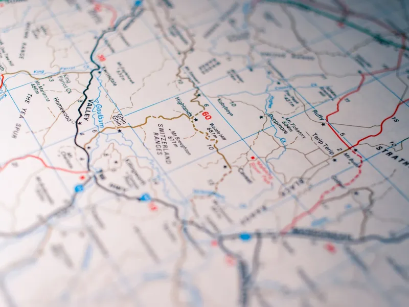
For longer trips, there was the road atlas. If you grew up in the 1970s, '80s, or '90s, you probably remember the Rand McNally — that thick, spiral-bound book with the red and blue highway lines and the little mileage tables in the back. It lived in the glove compartment or behind the passenger seat, slightly warped from years of being sat on, with certain pages soft and folded from repeated consultation.
Using it required a specific set of skills. You had to understand map scale, orient yourself relative to north, and maintain a running mental model of where you were in relation to where you were going. If you made a wrong turn, you didn't get an instant recalculation. You pulled over, found your location on the page, and figured out how to correct course — a process that required you to understand the structure of the road network rather than just follow a moving blue dot.
This was harder. It was also, in a meaningful sense, more educational. People who navigated by atlas developed genuine geographic literacy. They understood that interstate highways formed a numbered grid, that odd numbers run north-south and even numbers run east-west, that rivers and mountain ranges shaped the logic of where roads went. They built a mental architecture of the country that GPS users simply don't acquire.
When Locals Were the Algorithm
Before the atlas and the gas station map, there was the more ancient method: asking someone who knew. Pull into a diner, describe where you're trying to go, and let the person behind the counter reconstruct the route from memory. This happened millions of times a day across America for most of the twentieth century.
What made this work was local knowledge of a depth that no mapping application has ever fully replicated. The person at the diner counter knew that the bridge on Route 9 had been out since spring. They knew that the shortcut through Millfield saved fifteen minutes but turned to mud after rain. They knew that the sign for the Hendersons' place had blown down in the last storm, so you needed to count driveways instead. This was hyperlocal, real-time, experientially verified information — and it was freely given, usually with a refill of your coffee.
The transaction also had social texture. You were a stranger, and someone helped you. You thanked them, maybe bought a piece of pie, and went on your way slightly more connected to the fabric of a place you'd only just passed through. GPS didn't just replace the map. It replaced those moments.
The Confidence That Came From Getting Lost
Here's the counterintuitive part: getting lost, in the pre-GPS era, was actually useful. Not dangerously lost — not stranded-in-the-desert lost — but the ordinary kind of wrong-turn lost that forced you to problem-solve. You looked for landmarks. You reoriented. You made new decisions based on what you could observe around you. And when you found your way back, you understood the landscape a little better than you had before.
This process built what psychologists call spatial self-efficacy — the confidence that you can navigate unfamiliar environments without external help. It's a form of competence that transfers to other areas of life. People who know they can find their way tend to be more comfortable with uncertainty in general.
GPS, for all its genuine utility, has quietly eroded this confidence in ways that are only now becoming measurable. Research published in the last decade has documented declining performance on spatial navigation tasks among heavy GPS users. Studies of taxi drivers — one of the last professional groups that still navigates from memory — show significantly larger hippocampal development than average, suggesting that active wayfinding literally shapes the brain. We're not just outsourcing a skill. We may be changing the organ responsible for it.
The Place You Never Really Learned
There's a subtler loss, too, one that's harder to quantify. When you navigate by GPS, you experience a route as a sequence of instructions. Turn here, continue for two miles, turn there. You arrive at your destination having followed directions, but you haven't necessarily learned where you went. Ask someone who's driven a GPS-guided route a dozen times to draw a rough map of it, and many can't do it.
When you navigate from memory or from a paper map, you experience a route as a piece of geography. You understand how it connects to other roads, how it relates to the terrain, where it fits in the larger structure of a place. You build a mental model that accumulates over time into genuine knowledge of where you live and travel.
That knowledge used to be considered basic adult competence — the kind of thing you were expected to have, the way you were expected to know how to parallel park or read a weather sky. Its disappearance has been so gradual, and the replacement so convenient, that most people haven't noticed it's gone.
But somewhere out there, a grain elevator is still standing next to a county road. And nobody knows it's a landmark anymore.